


The Hanoi People's Committee has officially approved the task for a comprehensive adjustment of the Red River urban subdivision planning at a 1/5,000 scale. The project covers the section from Hong Ha Bridge to Me So Bridge.
The planning area encompasses the wards of Thuong Cat, Dong Ngac, Phu Thuong, Tay Ho, Hong Ha, Bo De, Long Bien, and Linh Nam, as well as the communes of O Dien, Me Linh, Thien Loc, Vinh Thanh, Dong Anh, Bat Trang, Thanh Tri, Nam Phu, and Hong Van.
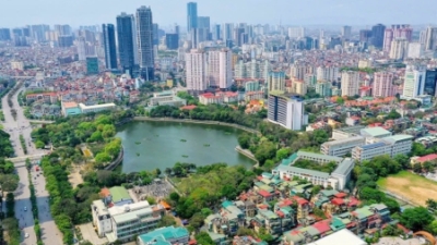
The study area for the adjustment stretches 40 km in a Northwest-Southeast direction, passing through the city’s central urban core. The total area designated for the planning adjustment is approximately 11,000 ha.
This move aims to update the capital's new long-term development orientations, providing a foundation for organizing the space on both sides of the river in a synchronous, sustainable, and safe manner.
In accordance with the adjusted Hanoi General Master Plan to 2045, with a vision to 2065, approved by the Prime Minister under Decision No. 1668/QD-TTg, dated December 17, 2024, the Red River urban subdivision is identified as part of the central urban area. Its primary character and function are defined as a signature spatial axis featuring greenery, water surfaces, cultural history, and the dominant landscape of the city center.
Regarding land-use structure, the planning area includes various functional categories, such as residential land, mixed-use land, urban public service land, high school land, and public greenery. It also allocates space for specialized greenery, historical and religious sites, security and defense, water surfaces, transportation, and technical infrastructure.
Based on these frameworks, the primary orientation is to transform the spaces along both sides of the Red River into a signature "green corridor" spatial axis of the capital city.


 Google translate